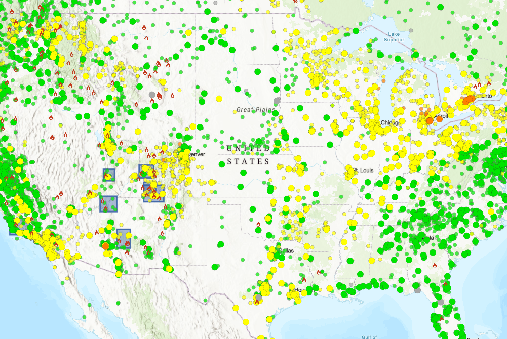
The AirNow Fire and Smoke Map
The AirNow Fire and Smoke Map is a free, easy-to-use online tool developed by the U.S. Environmental Protection Agency (EPA) and other federal agencies. It provides real-time data on:
- Active wildfires
- Smoke plumes and movement
- Air Quality Index (AQI) levels
- Sensor-based air quality readings in your area
This interactive map allows users to zoom into their location and view color-coded AQI readings ranging from “Good” (green) to “Hazardous” (maroon). It also displays icons for fire incidents and smoke forecasts, helping patients make informed decisions about outdoor exposure.
Why It Can Matter for Respiratory Health
Wildfire smoke can travel hundreds of miles, affecting air quality far beyond the fire zone1. For patients with chronic respiratory conditions, exposure to poor air quality can lead to1:
- Increased coughing and wheezing
- Shortness of breath
- Higher risk of hospitalization
- Reduced effectiveness of oxygen therapy or CPAP devices
The AirNow map, can allow patients to monitor conditions and take proactive steps to protect their health—such as staying indoors, using air purifiers, wearing N95 masks, or adjusting their treatment plans with guidance from their healthcare provider.
How to Use the Map
- Visit the Map: Go to https://fire.airnow.gov.
- Zoom In: Use the map controls to find your city or region.
- Check AQI Levels: Look for color-coded circles that indicate air quality.
- View Fire Activity: Click on fire icons to see details about active wildfires.
- Plan Accordingly: Use the information to decide whether it’s safe to go outside or if precautions are needed.
Lincare's Commitment to Patient Safety
At Lincare, we understand how environmental factors impact respiratory health. That’s why we encourage all patients to stay informed and prepared. Whether you're managing oxygen therapy, CPAP treatment, or other respiratory support, knowing your air quality is a part of protecting your health.
1 https://ww2.arb.ca.gov/smokereadyca#
Disclaimer: The tools and resources mentioned are provided for informational purposes only and do not constitute endorsement by Lincare. They are shared solely as examples of available options to support awareness and exploration. Users are encouraged to conduct their own research and evaluate suitability based on individual needs and circumstances.